 AVYCAST
Fiordland — Avalanche Forecast
Avalanche danger in Fiordland (New Zealand) is 2 — Moderate, valid for Monday, September 28, 2026. Published by New Zealand Avalanche Advisory.
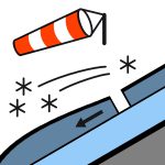
About 45-50mm of rain fell below 2100/2200m on Monday21st. The rest of the week saw small amounts of snow and rain with wildly fluctuating freezing levels. After a very warm Saturday temperatures will drop on Saturday night. On Sunday expect about 15cm snow down about 1900m, and rain and then about 5cm below that. Expect some windslab up at about 1900m above most of the weeks rain, and refrozen snow topped with a skiff of new snow below that. Generally safe travel at the low elevations, and some windslab up high.
Danger by Elevation
Active Avalanche Problems

20Sept - Little evidence of natural storm activity seen in the Homer area. 17th Sept- overflight from Te Anau to Milford track and across to the Routeburn- probably 40 or 50cm down to about 1800m and much less down to about 800m. Lots of evidence of loose snow activity during the storm. Slabs up high were difficult to spot with wind transported snow having refilled the crown walls. 16 Sept - no observers in the terrain. Expected some activity. 12 Sept - Numerous small size 1 loose dry and loose wet avalanches from a day or two earlier during/following the storm. Gertrude Saddle area 10 Sept - A storm slab avalanche cycle (up to sz 2-2.5) was noted from shaded aspects, many initiating at mid-path elevations with long shallow crown-lines suggesting surface hoar or facet forms present. This is in the Darran Mountains. Fiordland National Park Forecast for Sun 27th Sept 2026Rain, possibly heavy, turning to showers in the morning and falling as snow above 600 metres, but lowering to 400 metres before dawn. Thunderstorms and hail possible until afternoon.Wind at 1000 metres - Southwesterly 45 km/h, rising to gale westerly 65 km/h in the evening.Wind at 2000 metres - Southwesterly gale 65 km/h, rising to gale 85 km/h in the evening.Freezing level - 1600 metres sloping to 900 metres in the south, lowering to 600 metres everywhere before dawn. Rising to 1000 metres at night.Issued: 1:31pm Sat 26 Sep Take an ice axe and crampons if you are out exploring.
25th Sept- Snow down to about 1900m, rain below that. 22nd - About 5cm of snow down to 1100m, and strong W wind 21st Sept - About 50mm of rain 2100/2200m and below, most fell in 4 - 5 hours. 19 Sept- Up to 50cm snow from the west fell to about 1900m, with rain and snow below that. Expect dry snow above 1900m and wet and rain soaked snow below that. 16 Sept - Around 50 cm fell above about 1900m. Lesser amounts fell below that down to around 800m as temperatures cooled when the front passed. From 12th Sept - Gertrude saddle area. About 100cm snowpack depth at the 1400m, up to 180cm in sheltered areas. Snowline around 1000m. Surface conditions were a light dusting on top of a thick ~5cm rain crust above 1200m. The Sept 4 melt freeze crust was found approx. 25cm down. Well consolidated below that. 9th Sept - est about 20-30cm at higher elevations, with 10-15cm at 1100m, with strong SW . The Sep 9 precip event brought varied amounts (10-35 cm) of new snow in the Darran's. 7th - 8th Sept No precip, clear weather Observations from 8 Sept in the Darran's showed a wind affected upper snowpack with some exposed areas scoured back to a frozen surface (4th Sept rain crust, at about 1900/2000m and lower). Most areas had a thin melt-freeze crust over lighter drier snow over the thick rain crust (4/9). Developed surface hoar was evident at most shaded sites. Below the older rain crust, (around 1900/2000m and lower) was moist snow to deeper levels. A melt -freeze cycle was evident on sun affected slopes in the top 1-3 cm.
Source: New Zealand Avalanche Advisory · View Original Bulletin
Original (EN)
Frequently asked questions
What does avalanche danger level 2 (Moderate) mean?
Heightened avalanche conditions on some steep slopes — careful route selection and terrain evaluation are needed.
How often is the Fiordland forecast updated?
Avycast refreshes hourly; the bulletin is republished by New Zealand Avalanche Advisory usually once a day during the season.
Who publishes the Fiordland avalanche forecast?
New Zealand Avalanche Advisory — the official warning service. Avycast aggregates and translates it; always check the original bulletin.
Nearby Regions
- Queenstown · 91 km
- Wanaka · 98 km
- Aspiring · 108 km
- Ohau · 188 km
- Aoraki/Mt Cook · 253 km
- Two Thumbs · 274 km