 AVYCAST
Aspiring — Avalanche Forecast
Avalanche danger in Aspiring (New Zealand) is 3 — Considerable, valid for Monday, September 28, 2026. Published by New Zealand Avalanche Advisory.
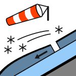
Be prepared for multiple problems on Sunday. New snow overnight may have formed touchy wind slabs, and by late morning, if the sun starts to show, we can expect a round of loose wet avalanches as the new snow starts to warm up. Plan your day carefully to avoid exposure to these problems, as they may change through the day.
Danger by Elevation
Active Avalanche Problems

There have been no significant avalanches reported recently. If you see any recent avalanche occurrences or have any relevant snowpack information or photos, you can share them via the Public Observations link on the NZAA home page. Mt Aspiring National Park ForecastForecastRain, heavy at times and falling as snow above 400 metres, gradually easing to isolated showers in the morning.Wind at 1000 metres Northwesterly 50 km/h, turning to southwesterly 40 km/h before dawn.Wind at 2000 metres Northwesterly 50 km/h, turning southwesterly gale 65 km/h before dawn, easing for a time in the morning.Wind at 3000 metres Westerly gale 85 km/h, rising to severe gale 100 km/h for a time before dawn, turning to southwesterly gale 65 km/h in the morning.Freezing level 1600 metres, lowering to 1000 metres before dawn.Issued: 1:31pm Sat 26 Sep Very slick conditions may lie just beneath any new snow that falls over Saturday night. Depending on your objective, an ice axe and crampons may be necessary in the current conditions.
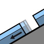
20- 40 cm of new snow overnight, tapering off to rain around 800m. 21/9, 20- 30 cm of new snow fell, tapering off to rain at around 1800m. Quantities were a lot less further east of the divide. 22-23/9, gale west-southwest winds redistributed most of this recent snowfall, leaving west aspects mostly stripped back to ice and east aspects with loading of variable depths. 16/9 , around 50cm of new snow fell to very low elevations, followed by strong westerly winds that redistributed much of the recent snow, stripping west-facing slopes and reloading the east-facing aspects. Around 25cm of new snow may have fallen above 2000m on the 19th. Above 2000m on south aspects in the Richardson and Forbes mountains, some moderate propagating results have been found 40- 50 cm beneath the surface under some layers of recent wind loading. Beneath this, the structure appears mostly well bonded with no other standout weaknesses.
Source: New Zealand Avalanche Advisory · View Original Bulletin
Original (EN)
Frequently asked questions
What does avalanche danger level 3 (Considerable) mean?
Dangerous avalanche conditions — a single person can trigger avalanches on many steep slopes; cautious route selection is essential.
How often is the Aspiring forecast updated?
Avycast refreshes hourly; the bulletin is republished by New Zealand Avalanche Advisory usually once a day during the season.
Who publishes the Aspiring avalanche forecast?
New Zealand Avalanche Advisory — the official warning service. Avycast aggregates and translates it; always check the original bulletin.
Nearby Regions
- Wanaka · 25 km
- Queenstown · 53 km
- Ohau · 90 km
- Fiordland · 108 km
- Aoraki/Mt Cook · 147 km
- Two Thumbs · 173 km