 AVYCAST
Ohau — Avalanche Forecast
Avalanche danger in Ohau (New Zealand) is 3 — Considerable, valid for Monday, September 28, 2026. Published by New Zealand Avalanche Advisory.
A fast-moving cold storm will bring heavy snow to low levels on Sunday. Avalanche danger will increase as fresh snow accumulates and then warms up. Take time to assess how well the new snow is bonding, and be aware of how quickly it can warm when exposed to the sun.
Danger by Elevation
Active Avalanche Problems
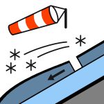

No recent avalanche observations were reported in the past 48 hours. South of Arthurs Pass: Snow developing before dawn, heavy at times above 400 metres, easing to isolated showers in the morning and clearing in the afternoon. Elsewhere: Rain developing in the morning, possibly heavy and falling as snow above 500 metres. Rain easing in the afternoon and clearing in the evening.wind at topSouthwesterly 50 km/h.freezing level600 rising to 1200 metres afternoon. A serious sliding hazard exists in the morning when the snowpack is refrozen hard. Carry an ice axe and crampons, and make sure you know how to use them effectively. Consider the consequences of a fall before committing to steep terrain.
The snowpack is generally well consolidated and has a typical spring character — firm and hard in the morning, then gradually softening as temperatures rise during the day.
Source: New Zealand Avalanche Advisory · View Original Bulletin
Original (EN)
Frequently asked questions
What does avalanche danger level 3 (Considerable) mean?
Dangerous avalanche conditions — a single person can trigger avalanches on many steep slopes; cautious route selection is essential.
How often is the Ohau forecast updated?
Avycast refreshes hourly; the bulletin is republished by New Zealand Avalanche Advisory usually once a day during the season.
Who publishes the Ohau avalanche forecast?
New Zealand Avalanche Advisory — the official warning service. Avycast aggregates and translates it; always check the original bulletin.
Nearby Regions
- Aoraki/Mt Cook · 77 km
- Two Thumbs · 87 km
- Wanaka · 90 km
- Aspiring · 90 km
- Queenstown · 101 km
- Mt Hutt · 164 km