 AVYCAST
Aoraki/Mt Cook — Avalanche Forecast
Avalanche danger in Aoraki/Mt Cook (New Zealand) is 3 — Considerable, valid for Sunday, September 27, 2026. Published by New Zealand Avalanche Advisory.
A significant storm is passing through on Sunday morning. In spring these storms are followed by rapid warming, which can increase the likelihood of natural avalanches. Avoid windloaded avalanche terrain and watch out for loose wet avalanching out of steep, sunny slopes if the sun comes out in the afternoon.
Danger by Elevation
Active Avalanche Problems
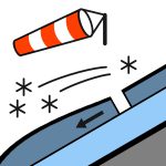

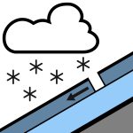
No new avalanches were observed in the last 48 hours. Snow, possibly heavy, easing in the afternoon and clearing by evening.Wind at 1000 metres: Northerly 50 km/h, rising to gale 70 km/h for a time before dawn then turning to southwesterly 40 km/h in the morning.Wind at 2000 metres: Northwesterly gale 70 km/h, turning to southwesterly 50 km/h before dawn.Wind at 3000 metres: Severe northwesterly gale 90 km/h, turning to southwesterly gale 70 km/h in the morning.Freezing level: 1800 metres, rapidly lowering to 800 metres before dawn, lifting to 1100 metres in the evening. There are slick crusts across the forecast region below about 2400m. Despite new snow on Sunday, strong to gale winds may expose these crusts. Crampons and ice axe are recommended.
Around 40cm of new snow fell near the Divide over the 24th and 25th above around 1800m, with snow totals tapering off at lower elevations and south of the Liebig range. This snow was redistributed by gale W winds on Saturday, forming deeper drifts and windslab on sheltered east facing slopes, and sits on a 5cm rain crust from the 21st of September up to 2400m. Those same gale W winds will have stripped west facing slopes back to this crust. Warmer temperatures, greenhousing and up to 10mm of precipitation on Saturday have capped the snowpack with a thin melt freeze crust up to around 2300m. The lower pack is generally well settled.
Source: New Zealand Avalanche Advisory · View Original Bulletin
Original (EN)
Frequently asked questions
What does avalanche danger level 3 (Considerable) mean?
Dangerous avalanche conditions — a single person can trigger avalanches on many steep slopes; cautious route selection is essential.
How often is the Aoraki/Mt Cook forecast updated?
Avycast refreshes hourly; the bulletin is republished by New Zealand Avalanche Advisory usually once a day during the season.
Who publishes the Aoraki/Mt Cook avalanche forecast?
New Zealand Avalanche Advisory — the official warning service. Avycast aggregates and translates it; always check the original bulletin.
Nearby Regions
- Two Thumbs · 45 km
- Ohau · 77 km
- Mt Hutt · 113 km
- Craigieburn Range · 128 km
- Arthur's Pass · 136 km
- Aspiring · 147 km