 AVYCAST
Queenstown — Bulletin d'avalanche
Le danger d'avalanche en Queenstown (Nouvelle-Zélande) est 3 — Marqué, valable pour dimanche 27 septembre 2026. Publié par New Zealand Avalanche Advisory.
Les plaques à vent récemment formées seront réactives ce matin. Évitez les zones de chargement évident et les zones de faible dévalaison. Une analyse experte du terrain et une prise de décision seront nécessaires pour un voyage en hors-piste en toute sécurité dès le début. Bien que le froid prédomine, des avalanches de neige humide et lâche seront possibles si le soleil fait une apparition.
Danger par altitude
Problèmes d'avalanches actifs
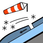

Aucune déclaration rapportée hier. Vents de nord-ouest violents en tendance sud-ouest le matin. La neige se calme lentement tout au long de la journée. Températures froides avec la FAFL tombant à 700 m. Les zones où la plaque à vent a dépouillé la nouvelle neige seront très glissantes. Les pentes exposées à l'ouest seront des zones à éviter.
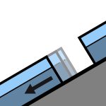
10-20 cm de neige récente tombés en altitude basse pendant la nuit. Probablement un chargement jusqu’à 80 cm sur les pentes sous le vent. Attente d’une liaison raisonnable avec la vieille surface humide et chaude dans la plupart des zones. Cela repose sur un manteau neigeux supérieur humide dans la plupart des zones. Les zones exposées aux vents et dépouillées seront gelées et glacées aujourd’hui. La couche intermédiaire et inférieure du manteau neigeux est généralement bien consolidée, mais les zones fines deviennent humides et non consolidées à moyenne et basse altitude. Des fissures de glissement et des déformations ont été observées sur les pentes ensoleillées à basse altitude.
Source: New Zealand Avalanche Advisory · Voir le bulletin d'origine
Traduit (EN)
Questions fréquentes
Que signifie le niveau de danger d'avalanche 3 (Marqué) ?
Conditions dangereuses — une seule personne peut déclencher des avalanches sur de nombreuses pentes raides ; la prudence dans le choix de l'itinéraire est essentielle.
À quelle fréquence le bulletin de Queenstown est-il mis à jour ?
Avycast actualise toutes les heures ; New Zealand Avalanche Advisory republie le bulletin généralement une fois par jour pendant la saison.
Qui publie le bulletin d'avalanche de Queenstown ?
New Zealand Avalanche Advisory — le service d'alerte officiel. Avycast l'agrège et le traduit ; consultez toujours le bulletin original.
Régions à proximité
- Wanaka · 28 km
- Aspiring · 53 km
- Fiordland · 91 km
- Ohau · 101 km
- Aoraki/Mt Cook · 173 km
- Two Thumbs · 188 km