 AVYCAST
Ohau — Bulletin d'avalanche
Le danger d'avalanche en Ohau (Nouvelle-Zélande) est 3 — Marqué, valable pour lundi 28 septembre 2026. Publié par New Zealand Avalanche Advisory.
Un storm froid à progression rapide apportera de fortes chutes de neige à basse altitude dimanche. Le danger d’avalanches augmentera à mesure que la nouvelle neige s’accumulera puis se réchauffera. Prenez le temps d’évaluer la qualité de l’adhérence de la nouvelle neige, et soyez conscient de la rapidité avec laquelle elle peut se réchauffer lorsqu’elle est exposée au soleil.
Danger par altitude
Problèmes d'avalanches actifs
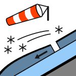

Aucune observation récente d’avalanches n’a été signalée au cours des 48 dernières heures. Au sud du passage d’Arthur : Neige en développement avant l’aube, forte à certains moments au-dessus de 400 mètres, se réduisant à des averses isolées le matin et dégagement dans l’après-midi. Ailleurs : Pluie en développement le matin, éventuellement forte et tombant sous forme de neige au-dessus de 500 mètres. La pluie faiblira l’après-midi et le ciel se dégagera en soirée. vent au sommet sud-ouest à 50 km/h. Niveau de gel : 600 mètres, montant à 1200 mètres dans l’après-midi. Un danger sérieux de glissement existe le matin lorsque le manteau neigeux est refreez dur. Transportez une pico et des crampons, et assurez-vous de savoir comment les utiliser efficacement. Réfléchissez aux conséquences d’une chute avant de vous engager sur un terrain escarpé.
Le manteau neigeux est généralement bien consolidé et présente un caractère typique de printemps — ferme et dure le matin, puis s’adoucissant progressivement à mesure que les températures augmentent durant la journée.
Source: New Zealand Avalanche Advisory · Voir le bulletin d'origine
Traduit (EN)
Questions fréquentes
Que signifie le niveau de danger d'avalanche 3 (Marqué) ?
Conditions dangereuses — une seule personne peut déclencher des avalanches sur de nombreuses pentes raides ; la prudence dans le choix de l'itinéraire est essentielle.
À quelle fréquence le bulletin de Ohau est-il mis à jour ?
Avycast actualise toutes les heures ; New Zealand Avalanche Advisory republie le bulletin généralement une fois par jour pendant la saison.
Qui publie le bulletin d'avalanche de Ohau ?
New Zealand Avalanche Advisory — le service d'alerte officiel. Avycast l'agrège et le traduit ; consultez toujours le bulletin original.
Régions à proximité
- Aoraki/Mt Cook · 77 km
- Two Thumbs · 87 km
- Wanaka · 90 km
- Aspiring · 90 km
- Queenstown · 101 km
- Mt Hutt · 164 km