 AVYCAST
Nelson Lakes — Avalanche Forecast
Avalanche danger in Nelson Lakes (New Zealand) is 3 — Considerable, valid for Monday, September 28, 2026. Published by New Zealand Avalanche Advisory.
Wind slab danger is likely on east-facing aspects, particularly at upper elevations.
Danger by Elevation
Active Avalanche Problems
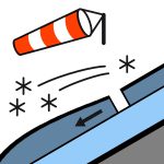

No observations. Please provide any snowpack or avalanche observations using the link below. https://www.avalanche.net.nz/observations Mostly fine, with an occasional afternoon showers on Monday. Gale-force southwest winds. Freezing level at 900m rising to 1300m. The snow may be hard. You'll need an ice axe and crampons!
Cover above 1800m is reasonably consistent, particularly in the west and south of the park. Snow cover is intermittent below 1800m particularly in the north and east of the park. Snow above 2000m may still be wind-transportable due to continued snow above that elevation. A lowering freezing level to 900 m, combined with strong winds from the westerly quarter and snow during Sunday, has continued to promote wind slab danger, particularly at upper elevations.
Source: New Zealand Avalanche Advisory · View Original Bulletin
Original (EN)
Frequently asked questions
What does avalanche danger level 3 (Considerable) mean?
Dangerous avalanche conditions — a single person can trigger avalanches on many steep slopes; cautious route selection is essential.
How often is the Nelson Lakes forecast updated?
Avycast refreshes hourly; the bulletin is republished by New Zealand Avalanche Advisory usually once a day during the season.
Who publishes the Nelson Lakes avalanche forecast?
New Zealand Avalanche Advisory — the official warning service. Avycast aggregates and translates it; always check the original bulletin.
Nearby Regions
- Arthur's Pass · 142 km
- Craigieburn Range · 162 km
- Mt Hutt · 192 km
- Two Thumbs · 260 km
- Aoraki/Mt Cook · 276 km
- Taranaki · 314 km