 AVYCAST
Nelson Lakes — Lawinenlagebericht
Die Lawinengefahr in Nelson Lakes (Neuseeland) ist 3 — Erheblich, gültig für Montag, 28. September 2026. Veröffentlicht von New Zealand Avalanche Advisory.
Übersetzung läuft — Anzeige in Originalsprache
Wind slab danger is likely on east-facing aspects, particularly at upper elevations.
Gefahr nach Höhenlage
Aktive Lawinenprobleme
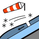

No observations. Please provide any snowpack or avalanche observations using the link below. https://www.avalanche.net.nz/observations Mostly fine, with an occasional afternoon showers on Monday. Gale-force southwest winds. Freezing level at 900m rising to 1300m. The snow may be hard. You'll need an ice axe and crampons!
Cover above 1800m is reasonably consistent, particularly in the west and south of the park. Snow cover is intermittent below 1800m particularly in the north and east of the park. Snow above 2000m may still be wind-transportable due to continued snow above that elevation. A lowering freezing level to 900 m, combined with strong winds from the westerly quarter and snow during Sunday, has continued to promote wind slab danger, particularly at upper elevations.
Quelle: New Zealand Avalanche Advisory · Original-Lagebericht ansehen
Original (EN)
Häufige Fragen
Was bedeutet Lawinengefahrenstufe 3 (Erheblich)?
Kritische Lawinensituation — eine einzelne Person kann an vielen Steilhängen Lawinen auslösen; vorsichtige Routenwahl ist unerlässlich.
Wie oft wird der Lagebericht für Nelson Lakes aktualisiert?
Avycast aktualisiert stündlich; New Zealand Avalanche Advisory veröffentlicht den Lagebericht in der Saison meist einmal täglich neu.
Wer veröffentlicht den Lawinenlagebericht für Nelson Lakes?
New Zealand Avalanche Advisory — der offizielle Lawinenwarndienst. Avycast bündelt und übersetzt ihn; prüfe immer den Originalbericht.
Regionen in der Nähe
- Arthur's Pass · 142 km
- Craigieburn Range · 162 km
- Mt Hutt · 192 km
- Two Thumbs · 260 km
- Aoraki/Mt Cook · 276 km
- Taranaki · 314 km