 AVYCAST
Two Thumbs — Лавинный прогноз
Лавинная опасность в регионе Two Thumbs (Новая Зеландия) — 3, Значительный, действует на понедельник, 28 сентября 2026 г.. Публикует New Zealand Avalanche Advisory.
Перевод выполняется — показан язык оригинала
Touchy windslabs are likely to be found at higher elevation. Expect a widespread loose wet avalanche cycle as the day heats up. Careful route finding and timing are key to a safe day out on Monday.
Опасность по высоте
Активные лавинные проблемы
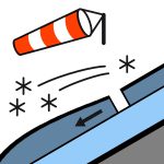

No recent avalanches have been reported in the area. However there has been limited visibility since the last snowfall. If you see any activity on the Two Thumb Range, please make a public observation. It helps us to produce accurate forecasts. Mainly fine.Wind at 1000 metresWesterly 35 km/h but 55 km/h in exposed places.Wind at 2000 metresWesterly gale 65 km/h.Freezing level1000 metres, lifting to 1300 metres in the morning. The new snow will go someway towards easing the sliding danger. However, windstripped slopes are likely to remain firm with lots of rocks in the runouts. Carrying ski crampons, ice axe and boot crampons and careful evaluation to the conditions is recommended.
More than 20cm of snow fell on Sunday. It was distributed by strong SW then W winds into deep drifts. Prior to this snowfall the snow pack was as follows: Sunny aspects: Mostly bare ground below about 1800m. What little snow is left has gone through multiple melt freeze cycles. Shady aspects: The eastern half has good snow cover above 1600m, reaching 100–120 cm in sheltered spots. Around 40cm on south to southwest slopes. Patches of wind drifted cold snow exist around ridges and terrain features. There are multiple crust layers in the shady snowpack interspersed with weak crystals. This structure is not a problem at present, but could cause elevated avalanche hazard with future loading.
Источник: New Zealand Avalanche Advisory · Открыть оригинал
Оригинал (EN)
Частые вопросы
Что означает уровень лавинной опасности 3 (Значительный)?
Опасные условия — один человек может спустить лавину на многих крутых склонах; осторожный выбор маршрута обязателен.
Как часто обновляется прогноз для региона Two Thumbs?
Avycast обновляет данные ежечасно; New Zealand Avalanche Advisory переиздаёт бюллетень обычно раз в день в течение сезона.
Кто публикует лавинный прогноз для региона Two Thumbs?
New Zealand Avalanche Advisory — официальная лавинная служба. Avycast агрегирует и переводит его; всегда сверяйтесь с оригинальным бюллетенем.
Регионы рядом
- Aoraki/Mt Cook · 45 km
- Mt Hutt · 78 km
- Ohau · 87 km
- Craigieburn Range · 101 km
- Arthur's Pass · 118 km
- Aspiring · 173 km