 AVYCAST
Craigieburn Range — Лавинный прогноз
Лавинная опасность в регионе Craigieburn Range (Новая Зеландия) — 3, Значительный, действует на понедельник, 28 сентября 2026 г.. Публикует New Zealand Avalanche Advisory.
В весенний снег обычно хорошо связывается, однако солнечное тепло сентября быстро увеличит опасность слабых слоёв влажного снега, если оно проявится во второй половине дня.
Опасность по высоте
Активные лавинные проблемы
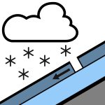

За последние 48 часов зарегистрировано отсутствия лавин. Воскресенье: Утром ожидается развитие дождя, возможно сильного, с выпадением в виде снега выше 500 м. Во второй половине дня дождь ослабеет, к вечеру прекратится. Ветры западного направления к утру сменятся на юго-западные. Уровень морозных температур 800 м. Понедельник: Изолированные осадки, с увеличением облачности. Сильные ветры западного и юго-западного направления. Уровень морозных температур 1000 м, поднимающийся до 1400 м к утру. Рекомендуется использовать ледоруб и кошки, так как поверхность снега может быть твёрдой, особенно утром, затем размягчаться в течение дня. Кошки для лыж будут полезны при катании на лыжах или сноуборде.
Покрытие снежного покрова по прогнозируемой области очень переменчиво. В некоторых местах до 150 см, в других — до покрытых инеем скал. Снежный покров сейчас изотермичен во всех районах ниже 1800 м. Теплая погода за последние недели создала снежный покров, похожий на весенний. Происходит хороший цикл таяния и замерзания, что способствует хорошему «корн-скиингу». За ночь и 23/09 выпало 10 см лёгкого сухого снега, а 24/09 — ещё 8 см.
Источник: New Zealand Avalanche Advisory · Открыть оригинал
Переведено (EN)
Частые вопросы
Что означает уровень лавинной опасности 3 (Значительный)?
Опасные условия — один человек может спустить лавину на многих крутых склонах; осторожный выбор маршрута обязателен.
Как часто обновляется прогноз для региона Craigieburn Range?
Avycast обновляет данные ежечасно; New Zealand Avalanche Advisory переиздаёт бюллетень обычно раз в день в течение сезона.
Кто публикует лавинный прогноз для региона Craigieburn Range?
New Zealand Avalanche Advisory — официальная лавинная служба. Avycast агрегирует и переводит его; всегда сверяйтесь с оригинальным бюллетенем.
Регионы рядом
- Arthur's Pass · 29 km
- Mt Hutt · 31 km
- Two Thumbs · 101 km
- Aoraki/Mt Cook · 128 km
- Nelson Lakes · 162 km
- Ohau · 188 km