Coquihalla-Harrison-Fraser-Manning-Skagit — Лавинный прогноз
Повышенные условия существуют на склонах с более глубокими накоплениями нового снега, особенно на больших высотах.
Опасность по высоте
Активные лавинные проблемы
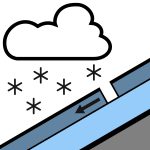
Буря во вторник следует за периодом низкой опасности и ограниченной активности лавин. В будущем опасения смещаются к новому снегу: изначально снегопадные доски в крутых районах, затем остающиеся ветровые доски и, в конце концов, влажные рыхлые лавины при солнце и потеплении. Если вы выходите в горный район, разместите МИНИМУМ!
Количество осадков будет варьироваться в зависимости от местоположения и высоты, поэтому проверяйте на месте и используйте более консервативные участки с более глубоким снеговым покровом. Ожидается около 30 см в районе Кукихаллы и долины Чиллиуак, и около 15 см в районе Мэннинг. Этот снег выпадает на смесь корок и влажного или изотермического снега, в зависимости от ориентации и высоты. Снежный покров прошел через несколько циклов таяния и замерзания, образовав серию корок с плотным, округлым снегом между ними. Глубина снежного покрова значительно уменьшается ниже 1000 м.
Источник: Avalanche Canada — Avalanche Canada · Открыть оригинал
Переведено (EN)
Открыть в приложении AvycastРегионы рядом
- Coquihalla-Harrison-Fraser-Manning-North Shore-Sasquatch · 37 km
- Coquihalla-Harrison-Fraser-Manning-North Shore-Powell River · 95 km
- Birkenhead-Duffey-South Chilcotin-Stein-Taseko · 179 km
- Birkenhead-Brandywine-Coquihalla-Duffey-East Island · 180 km
- Brandywine-Garibaldi-Homathko-North Shore-Powell River · 188 km
- Birkenhead-Brandywine-Duffey-Garibaldi-Homathko-South · 190 km