Coquihalla-Harrison-Fraser-Manning-Skagit — Boletín de aludes
Existen condiciones elevadas en pendientes con acumulaciones más profundas de nieve nueva, especialmente en altitudes más altas.
Peligro por cota
Problemas de aludes activos
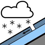
La tormenta del martes sigue a un período de bajo peligro y actividad limitada de aludes. Mirando hacia adelante, las preocupaciones se centran en la nieve nueva: inicialmente placas de tormenta en terreno empinado, luego placas de viento persistentes, y finalmente aludes de fondo húmedos y sueltos con el sol y el aumento de temperatura. Si sale al terreno no preparado, publique un MÍNIMO!
La cantidad de nieve caerá variada según la ubicación y la altitud, por lo que verifique en el campo y utilice terrenos más conservadores donde la acumulación de nieve sea mayor. Se esperan aproximadamente 30 cm en torno a Coquihalla y el valle de Chilliwack y cerca de 15 cm en Manning. Esta nieve cae sobre una mezcla de costras y nieve húmeda o isoterma, dependiendo del aspecto y la altitud. El manto nivoso ha experimentado múltiples ciclos de fusión y congelación, formando una serie de costras con nieve densa y redondeada entre ellas. La profundidad del manto nivoso disminuye significativamente por debajo de los 1000 m.
Fuente: Avalanche Canada — Avalanche Canada · Ver boletín original
Traducido (EN)
Abrir en la app AvycastRegiones cercanas
- Coquihalla-Harrison-Fraser-Manning-North Shore-Sasquatch · 37 km
- Coquihalla-Harrison-Fraser-Manning-North Shore-Powell River · 95 km
- Birkenhead-Duffey-South Chilcotin-Stein-Taseko · 179 km
- Birkenhead-Brandywine-Coquihalla-Duffey-East Island · 180 km
- Brandywine-Garibaldi-Homathko-North Shore-Powell River · 188 km
- Birkenhead-Brandywine-Duffey-Garibaldi-Homathko-South · 190 km