Coquihalla-Harrison-Fraser-Manning-Skagit — Lawinenlagebericht
Es bestehen erhöhte Bedingungen auf Hängen mit tieferen Neuschneemengen, insbesondere in höheren Lagen.
Gefahr nach Höhenlage
Aktive Lawinenprobleme
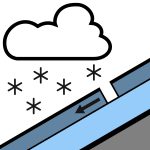
Der Sturm am Dienstag folgt einer Phase geringer Gefahr und begrenzter Lawinenaktivität. Blickt man in die Zukunft, verschieben sich die Bedenken auf den Neuschnee: zunächst Neuschneeansammlungen in steilem Gelände, dann anhaltende Triebschnee, und schließlich nasse Lockerschneelawinen bei Sonnenschein und Erwärmung. Wenn Sie sich im Backcountry bewegen, veröffentlichen Sie eine MIN!
Die Schneemengen variieren je nach Standort und Höhe, daher prüfen Sie vor Ort und wählen Sie bei tieferen Schneemengen vorsichtiges Gelände. Etwa 30 cm werden im Bereich Coquihalla und im Chilliwack-Tal erwartet, in Manning eher 15 cm. Dieser Schnee fällt auf eine Mischung aus crusts und feuchtem oder isothermischem Schnee, abhängig von der Exposition und Höhe. Die Schneedecke hat mehrere Schmelz- und Gefrierzyklen durchlaufen, wodurch eine Reihe von crusts mit dichtem, rundem Schnee dazwischen entstanden ist. Die Tiefe der Schneedecke nimmt unter 1000 m deutlich ab.
Quelle: Avalanche Canada — Avalanche Canada · Original-Lagebericht ansehen
Übersetzt (EN)
In der Avycast-App öffnenRegionen in der Nähe
- Coquihalla-Harrison-Fraser-Manning-North Shore-Sasquatch · 37 km
- Coquihalla-Harrison-Fraser-Manning-North Shore-Powell River · 95 km
- Birkenhead-Duffey-South Chilcotin-Stein-Taseko · 179 km
- Birkenhead-Brandywine-Coquihalla-Duffey-East Island · 180 km
- Brandywine-Garibaldi-Homathko-North Shore-Powell River · 188 km
- Birkenhead-Brandywine-Duffey-Garibaldi-Homathko-South · 190 km