 AVYCAST
Tongariro — Bulletin d'avalanche
Le danger d'avalanche en Tongariro (Nouvelle-Zélande) est 3 — Marqué, valable pour lundi 28 septembre 2026. Publié par New Zealand Avalanche Advisory.
Traduction en cours — affiché en langue source
Wind slab avalanches will likely form on east-facing terrain above 1800 metres. As winds back, poor visibility will continue, making it difficult to observe any recent activity or wind-loaded terrain features. Slick, firm surface conditions are still likely to exist on all aspects above 2300 metres. Weather conditions will slowly improve throughout the next 24 hours, but it will be wise to wait till Tuesday to step into the backcountry as the next high-pressure system settles in and we receive some consistent fine weather.
Danger par altitude
Problèmes d'avalanches actifs
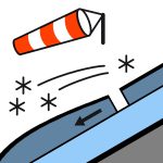
On 26/09/2026, Whakapapa ski patrol triggered multiple size 1 wind slab avalanches on north and northeast aspects above 2000 metres. Currently, skies are obscured, with gale westerly winds. Above 2000 metres, precipitation is starting to fall as snow, and this will lower as the freezing level continues to drop from 2000 metres to 1200 metres over the next 24 hours.Skies are forecast to remain obscured over the next 24 hours, possibly clearing in the morning on the north-east side of the national park. Winds are expected to decrease to moderate westerlies and swing to the southwest by midnight tonight.5-10cm of new snow is forecast to fall down to 1200m as the freezing level lowers and light precipitation continues. Previously, a thin layer of new snow (3- 5 cm) covered slick surface conditions on all aspects and elevations; these firm conditions have likely been broken down by the recent rainfall below 2300 metres but may still exist above 2300 metres. Carrying ice axe and crampons in the backcountry is strongly recommended, as they are key tools for navigating any alpine terrain this time of year.
In the past 24 hours, all aspects and elevations have received 30- 40 mm of rainfall, creating soft, slushy surface conditions in the upper snowpack. As the freezing level starts to lower throughout tonight, a melt-freeze crust is likely to form, creating a firm refrozen upper pack. Beneath these currently wet surface conditions is a consolidated, stable snowpack to ground. The current slope threshold sits at around 1900 metres; this is the elevation at which there is enough snow in start zones for avalanches to occur.
Source: New Zealand Avalanche Advisory · Voir le bulletin d'origine
Original (EN)
Questions fréquentes
Que signifie le niveau de danger d'avalanche 3 (Marqué) ?
Conditions dangereuses — une seule personne peut déclencher des avalanches sur de nombreuses pentes raides ; la prudence dans le choix de l'itinéraire est essentielle.
À quelle fréquence le bulletin de Tongariro est-il mis à jour ?
Avycast actualise toutes les heures ; New Zealand Avalanche Advisory republie le bulletin généralement une fois par jour pendant la saison.
Qui publie le bulletin d'avalanche de Tongariro ?
New Zealand Avalanche Advisory — le service d'alerte officiel. Avycast l'agrège et le traduit ; consultez toujours le bulletin original.
Régions à proximité
- Taranaki · 151 km
- Nelson Lakes · 387 km