 AVYCAST
Louchonnais — Avalanche Forecast
Avalanche danger in Louchonnais (France) is 1 — Low, valid for Sunday, November 22, 2026. Published by Meteo France.
Danger by Elevation
Active Avalanche Problems
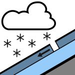
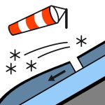
Problems extracted by AI from bulletin text. May be inaccurate.
WEAK WIND-LOADED SNOW LAYER. Triggering: on bare ground below 2000/2200 m or on a thin, stabilized snowpack in the steep gullies of the northern sectors; very wind-driven snowfalls, forming very thin slab structures on the West and North-West aspects, only slightly thicker on the North, East and lee aspects to the South. Thin, hard slabs that are difficult to trigger, causing only small avalanches.Spontaneous releases: in recent snow, on steep slopes, as snowfalls occur, but always small in size.Other: sustained west to North-West wind, turbulent under the snow showers; poor temporary visibility under these snow showers; temperatures remaining below freezing above 1700/1800 m.
Light dusting in the early morning from 1500 m, then a snow layer increasing gradually during the day under the snow showers. With the sustained wind, heterogeneous distribution of this fresh snow: wind-exposed slopes from West to North-West plastered over with a thin snow layer; small accumulations of very densified and compacted snow in lee areas.
Source: Meteo France · View Original Bulletin
Translated (FR)
Frequently asked questions
What does avalanche danger level 1 (Low) mean?
Generally favourable conditions — avalanches are possible mainly with high additional load on very steep terrain.
How often is the Louchonnais forecast updated?
Avycast refreshes hourly; the bulletin is republished by Meteo France usually once a day during the season.
Who publishes the Louchonnais avalanche forecast?
Meteo France — the official warning service. Avycast aggregates and translates it; always check the original bulletin.
Nearby Regions
- Saint-Cergue · 69 km
- Vallée de Joux · 73 km
- Chablais · 91 km
- Val de Travers · 105 km
- Yverdon - Bevaix · 105 km
- Bauges · 116 km