 AVYCAST
Bauges — Avalanche Forecast
Avalanche danger in Bauges (France) is 2 — Moderate, valid for Sunday, November 22, 2026. Published by Meteo France.
Danger by Elevation
Active Avalanche Problems
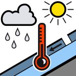
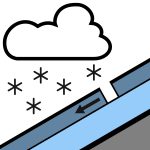
Problems extracted by AI from bulletin text. May be inaccurate.
New precipitation throughout the day with variations in the rain-snow level. Spontaneous releases:* Wet-snow avalanches, under the rain, especially in the morning, as the rain-snow level rises. Some releases to the ground are possible in steep, smooth slopes (grassy slopes, rock slabs). More frequent above 1800 m and with thicker fractures: size 1 to 2 (small to medium). Triggered releases:* Below 2200 m: wet snow may run under the skis. Possible from the beginning of the day on all aspects. Size 1 to 2 (small to medium).
Snowpack: For the season, the snowpack is in good condition. Skis can be put on above 1700/1800 m on grass. No base layer. Many stones barely covered. Snow quality this Sunday: In the morning, the snowpack becomes soaked, with rainfall, throughout its entire depth. Then, a new layer of snow gradually forms as the rain-snow level drops (5–10 cm possible by the end of the day around 1800 m).
Source: Meteo France · View Original Bulletin
Translated (FR)
Frequently asked questions
What does avalanche danger level 2 (Moderate) mean?
Heightened avalanche conditions on some steep slopes — careful route selection and terrain evaluation are needed.
How often is the Bauges forecast updated?
Avycast refreshes hourly; the bulletin is republished by Meteo France usually once a day during the season.
Who publishes the Bauges avalanche forecast?
Meteo France — the official warning service. Avycast aggregates and translates it; always check the original bulletin.
Nearby Regions
- Aravis · 30 km
- Beaufortain · 33 km
- Chartreuse · 51 km
- Maurienne · 54 km
- Belledonne · 56 km
- VAL VENY · 58 km