 AVYCAST
Chablais — Avalanche Forecast
Avalanche danger in Chablais (France) is 3 — Considerable, valid for Sunday, November 22, 2026. Published by Meteo France.
Danger by Elevation
Active Avalanche Problems
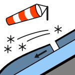
Problems extracted by AI from bulletin text. May be inaccurate.
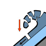
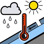
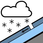
New precipitation throughout the day with variations in the rain-snow level. Spontaneous releases:* Above 2300 m: avalanches of fresh snow during snowfall, all day on Sunday. More numerous as the day progresses with the thickening of the snowpack. Snow falls under strong southwesterly to westerly wind, creating instabilities in the snow layer, as well as large accumulations. Thicker slab breaks at higher elevations. Size 2, rarely size 3 (medium, rarely large).* Below 2300 m: wet-snow avalanches, under the rain, especially in the morning, as the rain-snow level rises. Some releases to the ground are possible in steep, smooth slopes (grassy slopes, rock slabs). More numerous above 1700 m and toward the Swiss border, and with thicker breaks: size 2 (medium), rarely 3 (large). Smaller avalanches when descending in elevation. Triggered releases:* Above 2300 m: wind slabs in recent and fresh snow. Easily triggered. Increasing in number throughout Sunday’s snowfall. The slabs are thicker above 2600 m: mostly size 2 (medium). Instabilities are formed in particular by the strong westerly to southwesterly wind in recent days, but also on Sunday. These slabs are sometimes poorly visible. * Below 2300 m: wet snow may run under the skis. Possible from the beginning of the day on all aspects. Size 1 to 2 (small to medium).
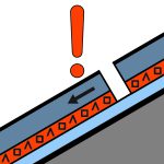
Snowpack: For the season, the snowpack is in good condition. Skis can be put on above 1400/1600 m on grass. Weak layer under 2300 m. Presence of large cornices and large drifts. Snow quality this Sunday:* Below 2300 m: in the morning, the snowpack becomes soaked with rainfall, over all or much of its depth. Then a new layer of snow gradually forms as the rain-snow level drops (7–15 cm possible by the end of the day toward 1800 m).* Above 2300 m: in the morning, 30–50 cm of cold snow, slightly heavier at the surface. During the day, the snowpack thickens, first with wet snow, then with colder snow (accumulations on the order of 20–30 cm in the evening). The snow is wind-affected, snowpack is uneven (numerous zones of accumulation and ablation).
Source: Meteo France · View Original Bulletin
Translated (FR)
Frequently asked questions
What does avalanche danger level 3 (Considerable) mean?
Dangerous avalanche conditions — a single person can trigger avalanches on many steep slopes; cautious route selection is essential.
How often is the Chablais forecast updated?
Avycast refreshes hourly; the bulletin is republished by Meteo France usually once a day during the season.
Who publishes the Chablais avalanche forecast?
Meteo France — the official warning service. Avycast aggregates and translates it; always check the original bulletin.
Nearby Regions
- Saint-Cergue · 26 km
- Vallée de Joux · 40 km
- Vouvry · 41 km
- Monthey - Val d'Illiez · 41 km
- Aravis · 45 km
- Emosson · 46 km