 AVYCAST
Beaufortain — Avalanche Forecast
Avalanche danger in Beaufortain (France) is 3 — Considerable, valid for Sunday, November 22, 2026. Published by Meteo France.
Danger by Elevation
Active Avalanche Problems
Problems extracted by AI from bulletin text. May be inaccurate.
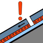
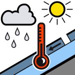
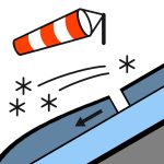
Rainy episode on an initially wintry snowpack. Spontaneous releases: - between 1800m and 2500m, wet-snow avalanches (small to medium sizes) occur under temporarily sustained rainfall from late night / early morning. They are more frequent on steep slopes, where the recent snow has remained only lightly wind-affected. Risk becoming low through the morning as the rain-snow level drops. Below 1800m, the amounts of snow that can be mobilized are lower, limiting the wet-snow problem.- above 2500m in the morning, then progressively lower as the hours pass, spontaneous avalanches may occur under snowfall. They increase in volume over the course of the hours to be generally size 2 by the end of the day. Human-triggered releases: above 2500m, where the snow has remained cold, a few easily triggered slabs. These slabs are thus found preferably on east-facing slopes / counter-slopes and are generally located on the leeward side of the prevailing wind (from the west). They are easily triggered and produce avalanches of size 1 to 2 (small to medium). Observations: wind transport of snow in real time, heavy local accumulation, cracking in front of the skis.
Snowpack: now excellent for the season from around 1800m, thanks to the series of weather disturbances endured this week. Skiable limit: from 1500/1600m on grass, rather 1800m on less favorable terrain. Watch out for “sharks” nonetheless, because the old hard sublayer is located rather around 2200m in the north and 2500m in the south. Snow quality: rain moistens the snowpack up to 2500m in the morning. Then the return of cold allows the wet snowpack to be covered with snow that is increasingly cold. In high mountains, strong wind distributes the snow unevenly during snowfall.
Source: Meteo France · View Original Bulletin
Translated (FR)
Frequently asked questions
What does avalanche danger level 3 (Considerable) mean?
Dangerous avalanche conditions — a single person can trigger avalanches on many steep slopes; cautious route selection is essential.
How often is the Beaufortain forecast updated?
Avycast refreshes hourly; the bulletin is republished by Meteo France usually once a day during the season.
Who publishes the Beaufortain avalanche forecast?
Meteo France — the official warning service. Avycast aggregates and translates it; always check the original bulletin.
Nearby Regions
- Aravis · 19 km
- VAL VENY · 26 km
- Haute-Tarentaise · 29 km
- VALLE DI LA THUILE · 30 km
- Bauges · 33 km
- Mont-Blanc · 34 km