Mont-Blanc — Avalanche Forecast
Danger by Elevation
Active Avalanche Problems

Problems extracted by AI from bulletin text. May be inaccurate.
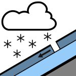
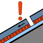
LAST BULLETIN OF THE SEASON. Triggered releases:* In the ubacs above 3400 m: rare loose wind slabs in recent snow (10 to 30 cm), fairly easily triggered by a skier. These slabs formed with W/SW wind on Friday and Saturday. These slabs may also be present in the adrets above 4000 m, where the recent snow has not yet been humidified. Size 1 (small), rarely 2 (medium). * Monday evening above 3400 m: some wind slabs form during snowfall. Thin slabs (10 cm), easily triggered by a skier. These slabs are formed by strong W wind. Size 1, rarely 2.* Above 2800 m: recent humid snow may slide under skis in the afternoon. Size 1. Spontaneous releases:* Above 2800 m, mainly in the ubacs: some small wet snow avalanches / loose wet snow avalanches as the sun shines, especially near rocks / cliffs. Size 1.
Snow cover: For the season, snow cover is below average. Skiing is possible above 2300 m in the North. Quality of the snow Monday: Below 2800 m, neve snow on all aspects, slight nocturnal refreezing above 2500 m. The snow humidifies quickly in the morning. Between 2800 m and 3400 m: still some heavy recent snow on a hard base. Crusted snow at the start of the day, melting during the morning. Above 3400 m in the North and 4000 m in the South: 10 to 15 cm of recent snow, fairly light, still little humidified. Wind-affected snow near ridges and summits. Monday evening above 3400 m: 5-10 cm of snow brought by showers. Snow often worked by the wind.
Source: Meteo France · View Original Bulletin
Translated (FR)
Open in the Avycast appNearby Regions
- VAL FERRET · 14 km
- VAL VENY · 16 km
- Génépi · 17 km
- Emosson · 18 km
- Val d'Entremont-Val Ferret · 22 km
- LA SALLE MORGEX · 24 km