 AVYCAST
Mt Hutt — Boletín de aludes
El peligro de aludes en Mt Hutt (Nueva Zelanda) es 2 — Limitado, válido para domingo, 27 de septiembre de 2026. Publicado por New Zealand Avalanche Advisory.
¡Domingo tormentoso! La nieve nueva en primavera suele conducir a un problema de placa de tormenta húmeda y suelta.
Peligro por cota
Problemas de aludes activos
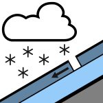

Una placa de viento de tamaño 1 fue activada por un esquiador en la Patrulla del Monte Hutt el sábado por la mañana. Esto ocurrió en una orientación sureste a 1800 m. Se pronostican hasta 15 cm de nieve a medida que un frente de SW de movimiento rápido pasa el domingo. La FAFL inicialmente a 600 m, pero aumenta a 1300 m a medida que el cielo se despeja. ¡Los crampones y un piolet son una buena idea para viajar en el terreno fuera de pista en primavera!
La nevada reciente provocó un calentamiento significativo durante todo el sábado. Hay poca estratificación notable, aparte de formas de fusión en la mitad norte. La mitad sur tiene múltiples capas de crustas enterradas que permanecen intactas, pero por lo demás está compuesta principalmente por formas de fusión. En general, un manto nivoso muy bien consolidado.
Fuente: New Zealand Avalanche Advisory · Ver boletín original
Traducido (EN)
Preguntas frecuentes
¿Qué significa el nivel de peligro de aludes 2 (Limitado)?
Peligro elevado en algunas laderas empinadas — se requiere una elección de itinerario y una evaluación del terreno cuidadosas.
¿Con qué frecuencia se actualiza el boletín de Mt Hutt?
Avycast se actualiza cada hora; New Zealand Avalanche Advisory vuelve a publicar el boletín normalmente una vez al día durante la temporada.
¿Quién publica el boletín de aludes de Mt Hutt?
New Zealand Avalanche Advisory — el servicio oficial de alerta. Avycast lo agrega y lo traduce; consulta siempre el boletín original.
Regiones cercanas
- Craigieburn Range · 31 km
- Arthur's Pass · 59 km
- Two Thumbs · 78 km
- Aoraki/Mt Cook · 113 km
- Ohau · 164 km
- Nelson Lakes · 192 km