 AVYCAST
Liechtenstein — Avalanche Forecast
Avalanche danger in Liechtenstein (Switzerland) is 2 — Moderate, valid for Sunday, November 22, 2026. Published by SLF.
Danger by Elevation
Active Avalanche Problems
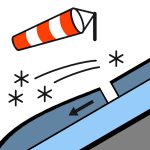
The new and wind-drifted snow from this week is stabilising. In the afternoon, with a little new snow and an increasing westerly wind, wind slabs will form. The snow distribution is very irregular. In wind-sheltered locations there are in some cases large wind slabs, while exposed terrain sections are scarcely snow-covered.
Source: SLF · View Original Bulletin
Original (EN)
Frequently asked questions
What does avalanche danger level 2 (Moderate) mean?
Heightened avalanche conditions on some steep slopes — careful route selection and terrain evaluation are needed.
How often is the Liechtenstein forecast updated?
Avycast refreshes hourly; the bulletin is republished by SLF usually once a day during the season.
Who publishes the Liechtenstein avalanche forecast?
SLF — the official warning service. Avycast aggregates and translates it; always check the original bulletin.
Nearby Regions
- Bex - Villars · 26 km
- Bienne - Neuchâtel · 28 km
- Hohgant · 37 km
- Jaun · 39 km
- Vallon de Saint-Imier · 43 km
- Niedersimmental · 43 km