 AVYCAST
Vanoise — Avalanche Forecast
Avalanche danger in Vanoise (France) is 2 — Moderate, valid for Sunday, November 15, 2026. Published by Meteo France.
Danger by Elevation
Active Avalanche Problems
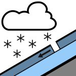
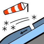

Problems extracted by AI from bulletin text. May be inaccurate.
New wind-driven instabilities. Triggering by people: - Above 2700/2800 m, a few new instabilities in wind-transported recent snow. These few small instabilities in loose or wind-densified snow are maintained by the small amounts of snowfall up to Sunday morning and by a fairly strong southwesterly wind throughout the day. These slabs cause small avalanches, size 1. - On north-facing slopes above 2800/3000 m, the persistent weak layers are still not deeply buried and therefore can be triggered. Breaks generally 30/40 cm, and up to 50 cm in better snow-covered areas, from Dent Parrachée to Grande-Motte. The extent of the slabs is still limited by the modest snow cover, so size 1 is expected mainly; in well-exposed, smooth terrain, the rare size 2 can be reached. - Below 2800/3000 m, the snowpack is thin and any instabilities are modest. Natural releases:.
Snow cover: the dusting of the alpine pastures does not hide the snow deficit very well, except in high mountains with a slightly more wintry appearance. Skiable limit: only in the north on the meadows above 2400 m, or on glaciers (not too crevassed). Snow quality: dusting from 1800/2000 m; the snowfall from Saturday night to Sunday provides 3/10 cm of wind-affected fresh snow without a new snow layer at 2200 m. In the north, the thickness of recent snow becomes significant from 2600 m (7/15 cm), then quickly 20/30 cm from 3000 m. Recent snow is often powdery over a hard surface, becoming wind-worked. New snow layer from 2300/2800 m, crusted around 2600/3000 m. In the south, you need to go above 2800 m to find wind-affected recent snow and often crusted snow.
Source: Meteo France · View Original Bulletin
Translated (FR)
Frequently asked questions
What does avalanche danger level 2 (Moderate) mean?
Heightened avalanche conditions on some steep slopes — careful route selection and terrain evaluation are needed.
How often is the Vanoise forecast updated?
Avycast refreshes hourly; the bulletin is republished by Meteo France usually once a day during the season.
Who publishes the Vanoise avalanche forecast?
Meteo France — the official warning service. Avycast aggregates and translates it; always check the original bulletin.
Nearby Regions
- Haute-Maurienne · 19 km
- Haute-Tarentaise · 25 km
- Maurienne · 32 km
- France · 35 km
- Thabor · 38 km
- Alpi Graie · 38 km