 AVYCAST
Renoso-Incudine — Avalanche Forecast
Avalanche danger in Renoso-Incudine (France) is 1 — Low, valid for Sunday, November 22, 2026. Published by Meteo France.
Danger by Elevation
Active Avalanche Problems
Problems extracted by AI from bulletin text. May be inaccurate.
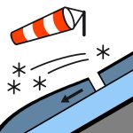
VERY LIGHT SNOWFALL No significant snow cover yet, with at most 10/20 cm of fresh snow (drifted snow) in the accumulations. The new wind-blown snowfalls, 5 to 10 cm, from this Sunday are occurring in the form of drifted snow. No avalanche risk a priori, or rare shallow slides on steep slopes that are more heavily loaded by the wind. Caution on the ground, locally hardened by freeze-thaw. Ridges and knolls are scoured by the wind, often wind-swept, rimed or icy.
Snow cover assessment: deficient for mid-November. Limits of skiable snow cover: skiing is impossible. Condition of the surface snow: the thin layer of snow that is forming consists essentially of drifted snow, leading to a very uneven distribution due to the action of the wind, alternating between wind-swept areas and small accumulations. Many icy surfaces at altitude and in shaded areas.
Source: Meteo France · View Original Bulletin
Translated (FR)
Frequently asked questions
What does avalanche danger level 1 (Low) mean?
Generally favourable conditions — avalanches are possible mainly with high additional load on very steep terrain.
How often is the Renoso-Incudine forecast updated?
Avycast refreshes hourly; the bulletin is republished by Meteo France usually once a day during the season.
Who publishes the Renoso-Incudine avalanche forecast?
Meteo France — the official warning service. Avycast aggregates and translates it; always check the original bulletin.
Nearby Regions
- Cinto-Rotondo · 66 km
- MeteoMont · 211 km
- TOSCANA / Monte Amiata · 230 km
- TOSCANA / Alpi Apuane - Appennino Toscano settentrionale · 261 km
- Alpi Liguri · 273 km
- PIEMONTE / Alpi Liguri nord · 273 km