 AVYCAST
Haute-Bigorre — Avalanche Forecast
Avalanche danger in Haute-Bigorre (France) is 1 — Low, valid for Sunday, November 15, 2026. Published by Meteo France.
Danger by Elevation
Active Avalanche Problems
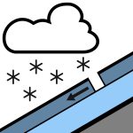

Problems extracted by AI from bulletin text. May be inaccurate.
SOME ACCUMULATIONS AT ELEVATION. Spontaneous releases: above 2400 m, rare, small, isolated releases in recent snow, generally on steep slopes in leeward north-facing sectors with small accumulations.Triggered releases: no real slab structure in place to allow a triggered release, despite snow showers above 2100/2200 m that are strongly wind-exposed; a dusting of a few centimeters, rather deposited in the north sheltered from the wind but on a very thin, stable and often refrozen sublayer above 2500/2600 m.Other: strong southwesterly to westerly wind, strong gusts in the morning, significant snow transport at elevation.
Whitewashed slopes above 2300/2400 m Sunday morning. A little very wind-exposed fresh snow settles in the afternoon, on a refrozen surface above 2500/2600 m, giving a uniform but deceptive appearance (very little snow on the ground) in the steep, wind-sheltered gullies of the north-facing sectors.
Source: Meteo France · View Original Bulletin
Translated (FR)
Frequently asked questions
What does avalanche danger level 1 (Low) mean?
Generally favourable conditions — avalanches are possible mainly with high additional load on very steep terrain.
How often is the Haute-Bigorre forecast updated?
Avycast refreshes hourly; the bulletin is republished by Meteo France usually once a day during the season.
Who publishes the Haute-Bigorre avalanche forecast?
Meteo France — the official warning service. Avycast aggregates and translates it; always check the original bulletin.
Nearby Regions
- Aure-Louron · 23 km
- Alto Gállego · 48 km
- Spain · 49 km
- Pirineo navarro · 58 km
- Aspe-Ossau · 63 km
- North and center of Aran · 64 km