Blue River-Clearwater-Gold-Jordan-North Monashee-North Okanagan-Shuswap-Whatshan — Avalanche Forecast
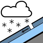
Freshly formed storm slabs will be most reactive on lee features at upper elevations on Wednesday.Stay alert to conditions that change with elevation, aspect, and exposure to wind.
Danger by Elevation
Active Avalanche Problems
No new avalanches were reported on Monday.Observations are currently very limited in this region. Please consider submitting a MIN to let us know what you're seeing out there.
Forecast snow and southwest wind will form fresh storm slabs that will be most reactive on lee features at upper elevations. Below the recent snow is a hard crust that exists on all aspects to at least 2500 m.Crusts from late March can be found down 20 to 80 cm, depending on elevation/aspect.The mid and lower snowpack is well settled and strong in most areas.
Source: Avalanche Canada — Avalanche Canada · View Original Bulletin
Original (EN)
Open in the Avycast appNearby Regions
- Badshot-Battle-Blue River-Central Selkirk-Clearwater-Esplanade-Gold-Jordan-North Monashee-North Okanagan-North Selkirk-Shuswap-Whatshan · 20 km
- Clearwater-Gold-Jordan-North Okanagan-Shuswap-Whatshan · 22 km
- Badshot-Battle-Blue River-Central Selkirk-Clearwater-Esplanade-Goat-Gold-Jordan-North Monashee-North Okanagan-North Selkirk-Shuswap-Whatshan · 27 km
- Akamina-Badshot-Battle-Blue River-Bonnington-Bull-Central Selkirk-Clearwater-Clemina-Crawford-Crowsnest North-Crowsnest South-Dogtooth-East Kakwa-East Purcell-Elkford East-Elkford West-Esplanade-Flathead-Goat-Gold-Grohman-Jordan-Kakwa-Kokanee-Kootenay Pass-Lizard-McBride-McGregor-Moyie-Norns-North Monashee-North Okanagan-North Selkirk-Pine Pass-Premier-Quesnel-Renshaw-Retallack-Robson-Rossland-Shuswap-South Okanagan-St. Mary-Sugarbowl-Tumbler-Valhalla-West Purcell-Whatshan-Ymir · 78 km
- Badshot-Battle-Blue River-Bonnington-Central Selkirk-Clearwater-Esplanade-Goat-Gold-Grohman-Jordan-Kokanee-Kootenay Pass-Norns-North Monashee-North Okanagan-North Selkirk-Retallack-Rossland-Shuswap-South Okanagan-Valhalla-Whatshan-Ymir · 82 km
- Badshot-Battle-Central Selkirk-Esplanade-Goat-North Selkirk · 96 km