Akamina-Bonnington-Crawford-Flathead-Grohman-Kokanee-Kootenay Pass-Lizard-Moyie-Norns-Retallack-Rossland-South Okanagan-St. Mary-Valhalla-Ymir — Avalanche Forecast
Investigate how the new snow is bonding to the underlying layers in your area. Snowfall amounts vary greatly; the danger is likely one step lower in areas that didn't receive at least 15 cm.
Danger by Elevation
Active Avalanche Problems
On Wednesday, west of Creston, ski cuts produced small storm slabs failing 25 cm deep. Looking forward, riders could trigger storm slabs at higher elevations, particularly if they don't bond well to underlying old surfaces.Please consider submitting a MIN to let us know what you're seeing out there.
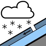
Anywhere from 15 to 50 cm of snow has fallen on Tuesday and Wednesday. This snow either sits on moist snow around treeline or likely on a crust in the alpine.The snow also fell with moderate to strong winds, forming deeper deposits in lee terrain features. Below 1500 m, all this precipitation fell as rain, wetting an already wet and melting snowpack.The remainder of the snowpack is strong.
Source: Avalanche Canada — Avalanche Canada · View Original Bulletin
Original (EN)
Open in the Avycast appNearby Regions
- Akamina-Bonnington-Crawford-Flathead-Goat-Grohman-Kokanee-Kootenay Pass-Lizard-Moyie-Norns-Retallack-Rossland-South Okanagan-St. Mary-Valhalla-Ymir · 7 km
- Bonnington-Crawford-Goat-Grohman-Kokanee-Kootenay Pass-Norns-Retallack-Rossland-South Okanagan-St. Mary-Valhalla-Ymir · 46 km
- Crawford-Dogtooth-East Purcell-Moyie-St. Mary-West Purcell · 89 km
- Dogtooth-East Purcell-West Purcell · 127 km
- Akamina-Bull-Crowsnest North-Crowsnest South-Elkford East-Elkford West-Flathead-Lizard-Moyie · 153 km
- Badshot-Battle-Blue River-Bonnington-Central Selkirk-Clearwater-Esplanade-Goat-Gold-Grohman-Jordan-Kokanee-Kootenay Pass-Norns-North Monashee-North Okanagan-North Selkirk-Retallack-Rossland-Shuswap-South Okanagan-Valhalla-Whatshan-Ymir · 154 km