Badshot-Battle-Blue River-Central Selkirk-Clearwater-Esplanade-Goat-Gold-Jordan-North Monashee-North Okanagan-North Selkirk-Shuswap-Whatshan — Lawinenlagebericht
Übersetzung läuft — Anzeige in Originalsprache
Strong solar radiation may increase the reactivity of recently formed storm slabs.Avoid steep, sun-exposed slopes when solar radiation is strong.
Gefahr nach Höhenlage
Aktive Lawinenprobleme


On Tuesday, a couple of naturally triggered wind slabs up to size 2 were reported on northerly aspects in the alpine.Several skier triggered size 1 wind slabs were also reported on steep slopes in the alpine.Observations are currently very limited in this region. Please consider submitting a MIN to let us know what you're seeing out there.
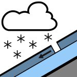
20 to 40 cm of recent snow and southerly wind formed storm slabs that will be most reactive on lee features at upper elevations.Below the recent snow is a hard crust that exists on all aspects to at least 2500 m.The mid and lower snowpack is well settled and strong in most areas.
Quelle: Avalanche Canada — Avalanche Canada · Original-Lagebericht ansehen
Original (EN)
In der Avycast-App öffnenRegionen in der Nähe
- Badshot-Battle-Blue River-Central Selkirk-Clearwater-Esplanade-Gold-Jordan-North Monashee-North Okanagan-North Selkirk-Shuswap-Whatshan · 9 km
- Blue River-Clearwater-Gold-Jordan-North Monashee-North Okanagan-Shuswap-Whatshan · 27 km
- Clearwater-Gold-Jordan-North Okanagan-Shuswap-Whatshan · 31 km
- Badshot-Battle-Blue River-Bonnington-Central Selkirk-Clearwater-Esplanade-Goat-Gold-Grohman-Jordan-Kokanee-Kootenay Pass-Norns-North Monashee-North Okanagan-North Selkirk-Retallack-Rossland-Shuswap-South Okanagan-Valhalla-Whatshan-Ymir · 67 km
- Badshot-Battle-Central Selkirk-Esplanade-Goat-North Selkirk · 69 km
- Glacier · 87 km